Promoting Gender Equality through Women-led Agroecology in West Africa.
TINIGUENA, Guine Bissau
Eradicating poverty, reducing inequalities, and achieving sustainable development in the Global South should mobilize our common interests, in a way fostering an inclusive and green transition in the emerging digital age. It requires a cultural movement throughout all areas of knowledge to promote the use of data derived from Earth Observation systems in combination with other advanced data acquisition and processing systems, to enable innovative policies and practices driven by new research dealing with complex landscapes, including those in vulnerable urban areas and rural landscapes.
K4P Alliances is a joint venture aiming to stimulate institutional collaboration and initiatives aimed at achieving the goal of carbon neutrality, or "net zero", by 2050, through long-term sustainable pilot projects in Latin America and Africa that foster research and innovation activities with the active participation of local communities.
The pilot projects and their sustainability will be implemented through forms of collaborative institutional frameworks promoting “data ecologies” oriented towards sustainable urban growth, as well as blue and green growth. They may take the form of “Collaborative Laboratories” engaging people and experts throughout all areas of knowledge and involving interface and intermediation activities with the public and private sectors, as well as civil society organizations and local actors.
The ultimate goal is to promote Sustainable and Healthy Territories giving priority to “Human Agency”, through research and innovative social practices, together with job creation and initiatives stimulating the ecological transition of the economy and society.
K4P Alliances has been designed and launched with 4 main lines of action, as follows:
K4P Alliances Action Lines
Motivation
We argue that while intergovernmental organizations continue to assess and discuss their agendas[1], there is a need to leverage international networks acting in the Global South and foster cross-interactions of scientists, governments, industry and policy actors to enable the rapid development of research and innovations in strategic areas and the flexibility and adaptive capacity of researchers required to face a constantly changing society and related new complex challenges. In addition, it is becoming crucial to inform future governance and policy issues, which inevitably intersect with academic research, technology developments and innovative solutions in this realm.
The analysis will be focused on complex urban environments and landscapes in Africa and Latin America, which are particularly critical for the required green transition and our global well-being[2]. It will include urban systems[3], value chains associated with food production, processing and circulation and the resources required to all the steps, farming, forests and the ocean, taking into account emerging forms of knowledge production and diffusion in a decentralized and AI-supported digital age.
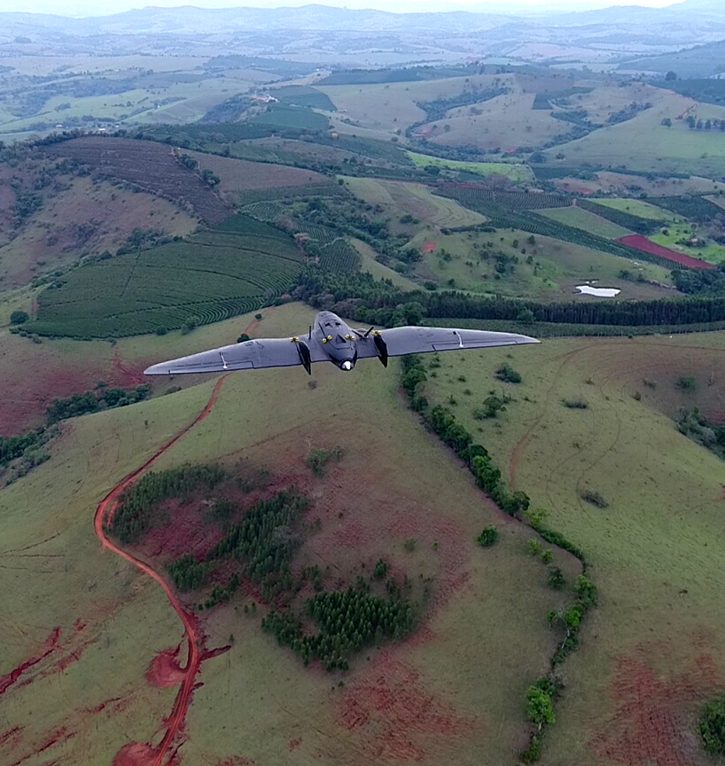
In particular, promoting new fundamental research fostering our global safety and the prevention of natural disasters and other uncertainties associated with climate change have garnered a growing interest over the last few years[4]. This includes the absolute need to accelerate the transition to carbon neutrality and to better use advanced Earth Observation systems if adequately integrated with in situ sensors and modelling.
We all know that digital systems are undergoing a rapid transformation and expansion on a global scale in association with new business models and new players, including emerging new relationships with institutional sectors and a broad range of entrepreneurial activities in several technical fields associated with decentralized digital networks.
At the same time, citizens at large face increasing challenges and their quality of life and sustainable future can only be secured effectively through a new generation of user-driven technology systems, making citizens an integral part and key staheholders of future developments.
It is in this context that we focus the “K4P Alliances” on the need to guarantee carbon neutrality, addressing the impending climate disaster, as well as our global safety, this being the central endeavour which should drive technology governance in a digital age, including in the Global South. Advanced Earth Observation methods and space-related communication and autonomous systems are part of this overall challenge. They represent an emerging opportunity for the adoption of carbon markets, together with decentralized digital networks together with AI-enabled innovations through public-private interactions.
Our argument is that all this requires a revisted “digital humanism”, together with rethinking of techno-centric narratives of progress, embracing and harnessing uncertainty, as well as abandoning the fantasy of control over nature and the illusion of techno-centric dominance of digital systems and AI-enable innovations.
To save lives, predict natural disasters, prevent fires, control erosion of coastal areas, as well as providing quality food and services for all, can only be secured effectively through a new generation of user-driven, low-cost, space-based observation and human-based participatory systems, which require adequate resources that can only be obtained if citizens become an integral part of future developments. In addition, dealing with climate change, dramatic biodiversity reduction, health and economic crisis, uncertainty and risks, together with ensuring security and safe conditions for our populations can only be addressed if new digital initiatives move forward in full alignment with a required green transition.
In addition, the critical point to note is that developing decentralized digital networks together with space-based systems and AI-enabled innovations for safety and security requires consideration of adequate “time to value”, because it requires extra steps, software, and, above all, education and research. In particular, their successful implementation may depend on the following far-reaching ambitious steps: i) Pursuing quantum technology and in-orbit demonstration and validation activities for upgrading Earth Observation, science and navigation data and services; ii) setting-up an optical communication network in space, seeking to do so in partnership with terrestrial network providers to setup an integrated network. This “network” should extend beyond low Earth orbits by establishing an interplanetary internet; iii) A collective effort for the responsible use of space is mandatory by all space actors to ensure safe access to space.
Overall, evolving forms of technology governance and the introduction of digital standards should be oriented to guarantee improved collective user responsibility in an emerging decentralized digital age boosted by AI-enabled innovations. Promoting “Human Agency” and empowering people and users at large will promote the need to educate and train every single user and this can only be achieved by boosting research and innovation, growth and competitiveness. It should include smaller companies and start-ups, stimulating forms of free and open competition with very large players. In addition, technology governance should facilitate access and use of data by consumers, while providing incentives for them to invest in ways to generate value through data, as well as to safeguard situations of illegal transfer of data and to fight against mendacity (e.g., Jay, 2010).
It should be emphasized that satellite earth observation is important for society and economy for several reasons:
- First, satellite data adequality integrated in advanced information systems can be used to monitor and protect coastal areas, maritime traffic and the biodiversity of the ocean, as well as to create the “digital twin” of the ocean to model and promote new activities under the scope of the blue economy. For example, satellite data can be used to track the movements of fish stocks, identify areas of Illegal fishing, and monitor the health of coral reefs. This information can be used to improve the management of fisheries and to support the sustainable development of the blue economy.
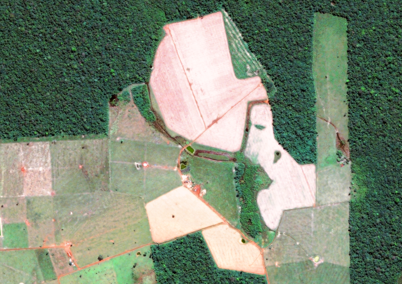
- Second, satellite data adequality integrated in advanced information systems can help us better understand and manage our natural resources if adequality integrated with in-situ data and advanced information systems. For example, satellite data can be used to build “digital twins” of agro-forestry structures and mountains, which will allow to monitor natural products and to foster sustainable agricultural production and help farmers optimize their use of water and fertilizer. This can lead to increased crop yields and improved food security.
- Finally, satellite data can be used to monitor and mitigate the effects of climate change through the effective use of “digital twins” of the ocean and specific landscapes. For example, satellite data can be used to track the expansion of deserts and the effects of drought and floods. This information can be used to support the development of adaptation and mitigation strategies.
[1] See, for example the recent case of the European Space Agency: https://vision.esa.int/the-matosinhos-manifesto-accelerating-the-use-of-space-in-europe/
[2] See, for example, Zhao, J, Gladson, L. and Cromar, K. (2018),“A Novel Environmental Justice Indicator for Managing Local Air Pollution”, Int. J. Environ. Res. Public Health 2018, 15(6), 1260.
[3] Bettencourt, L. (2021); “Introduction to Urban Science”, MIT Press.
[4] Gates, W. (2021), “How to avoid a climate disaster: the solutions we have and the breakthroughs we need”, Alfred A. Knopf. New York: Penguim Books.